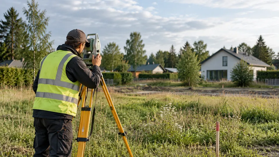
Preliminary studies
What Is a Geodetic Base Plan and When Do You Need One?
A geodetic base plan shows the existing conditions of a property. Find out what it includes, when you might need one, and what to check before ordering a survey.
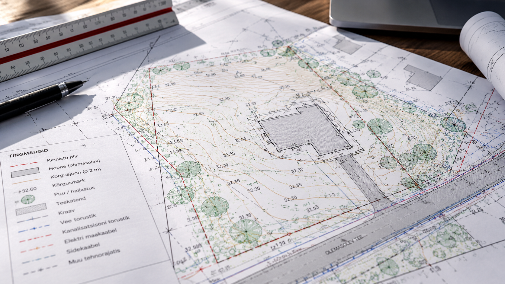
Before building a house, planning an extension, or redesigning a plot, it is important to understand the actual conditions of the site. A geodetic base plan, also known as a topographic survey plan, brings together information needed for design, such as ground elevations, existing buildings, roads, and utility networks. It helps the designer develop a solution that fits the actual site and its conditions.
What Is a Geodetic Base Plan?
A geodetic base plan is a site plan prepared following a topographic-geodetic survey. During the survey, the existing conditions of the area associated with a proposed building or planning project are identified, described, and documented. The purpose is to provide planners and designers with reliable baseline data, rather than to develop the future design itself.
Depending on the scope of work, a geodetic base plan may show:
- Ground elevations and terrain features.
- Existing buildings, structures, and other visible site features.
- Roads, access routes, paved surfaces, and other parts of the site.
- Cadastral parcel boundaries shown on the basis of the survey area and available source data.
- Utility networks and related structures, to the extent that they have been identified during the survey or obtained from relevant records.
The exact content of the plan depends on the survey area, the project brief, and the needs of the specific project. Before commissioning the work, it is therefore advisable to agree with the designer on which data are required and in what format they should be delivered.
When Might You Need a Geodetic Base Plan?
A geodetic base plan is often used when an accurate and up-to-date overview of the existing site is needed to prepare a design. It may be necessary or useful as a starting point in situations such as:
- Planning a new house or another building.
- Preparing an extension or alterations to an existing building.
- Planning outbuildings, terraces, retaining walls, access routes, or other outdoor structures.
- Designing site levels, stormwater drainage, or landscaping.
- Planning utility networks or clarifying existing site conditions.
- Collecting spatial data required for a detailed plan or building design project.
This does not mean that a new geodetic base plan must automatically be commissioned for every construction project. The need depends on the nature of the proposed work, how up to date the existing data are, the designer’s brief, and the requirements applicable to the location. The best approach is to clarify this with the designer or local authority before placing an order.
What Does a Geodetic Base Plan Show—and What Does It Not Show?
A geodetic base plan describes the conditions identified at the time of the survey. It is not a completed building design and does not, by itself, include every investigation needed to plan a future building. For example, a separate engineering-geological investigation may be needed to assess soil layers and ground conditions. Measuring an existing building may be necessary to document its internal spaces accurately.
Property boundaries also require attention. A cadastral boundary shown on the plan is based on existing boundary data and may not establish the boundary’s position on the ground with sufficient accuracy. If you are planning a building or structure close to a boundary, or if the boundary location is unclear, seek advice from a licensed land surveyor. Cadastral surveying and the preparation of a geodetic base plan serve different purposes.
Can an Existing Geodetic Base Plan Be Reused?
Sometimes, yes. However, before deciding, check whether the existing plan reflects current conditions, covers the area needed for the proposed work, and contains the information required for the project. New buildings, structures, or utility networks may have been added to the site, and ground levels or access routes may have changed.
Do not assume that an old file is automatically suitable for a new project—or that it is no longer suitable simply because of its age. Show the plan to the designer or surveyor and ask whether it can be reused, updated, or whether a new survey is needed. Also check whether the local authority or the project brief imposes any additional requirements.
How to Commission a Geodetic Base Plan: Four Practical Steps
-
Describe the proposed work. Are you planning a new house, an extension, outdoor structures, or improvements to the entire plot? Provide the property location and outline your main requirements.
-
Ask the designer what is needed. Find out how large an area must be surveyed, how detailed the data need to be, and whether existing survey information can be used.
-
Give the surveyor a clear brief. Provide the address or cadastral reference number, a description of the proposed work, and any existing plans or documents. Agree on the digital file formats and the materials to be delivered.
-
Check the results before design work begins. Together with the designer, make sure the delivered plan covers the required area and includes the data agreed for the project.
What Should You Check in a Quotation?
When you receive a quotation for preparing a geodetic base plan, compare offers based on the same scope of work. The total price alone may not show whether the proposed services and deliverables are comparable. Before confirming an order, check the following:
- Whether the survey area and required accuracy meet the designer’s stated needs.
- Which existing and underground utility networks will be included and what data will be used to show them on the plan.
- Which files and documents will be delivered, such as a digital drawing, a PDF extract, and, if necessary, a survey report.
- When the fieldwork will take place and when the results will be delivered.
- Whether any additional requirements need to be clarified with the local authority or utility network operators before work begins.
If you are unsure what level of detail or file format the designer needs, clarify this before requesting quotations. A clear brief helps avoid situations where the commissioned plan later needs to be supplemented or the site surveyed again.
Frequently Asked Questions
Is a geodetic base plan the same as a cadastral survey?
No. A geodetic base plan describes existing site conditions to provide baseline data for a project. A cadastral survey is intended to establish or clarify property boundaries in accordance with the applicable procedures. If you need certainty about the exact location of a boundary, contact a licensed land surveyor.
Is a new geodetic base plan definitely required for every house?
Not automatically in every situation. The need depends on the proposed building, the baseline data required for design, whether the existing plan is suitable, and the requirements applicable to the location. Check with the designer before commissioning the work and, if necessary, consult the local authority.
What should I prepare before requesting a quotation?
Have the property address or cadastral reference number ready, along with a brief description of the proposed work and any existing plans or surveys. Also ask which file formats will be provided and whether the quotation includes all the survey data required for your project.
Before Submitting an Enquiry
Once you know what type of geodetic base plan or survey your project requires, you can submit a free enquiry through BeforeBuilding. Describe the property and the proposed work, and attach any available baseline information. You can then review the specialists interested in your enquiry and choose which companies you would like to ask for a quotation.
Useful Sources
- Requirements for Topographic-Geodetic Surveys and As-Built Surveys – Riigi Teataja
- Building Code – Riigi Teataja
- A Licensed Land Surveyor Determines Exact Boundaries – Estonian Land and Spatial Development Board
The need for a geodetic base plan and its required content depend on the specific project and the requirements applicable to the location. Before commissioning the work, clarify the scope with the designer, surveyor, and, if necessary, the local authority.